The lunar atlas.
Explore named terrain, illustrated geophysical layers, landing sites, and the Moon’s connection to Earth. Start with a layer; follow a feature.
Explore the surface
NASA surface imagery and selected lunar features. Other layers are conceptual illustrations.
North-up sphere · fixed study lighting, not today’s lunar phase. Marker sizes are symbolic; no terrain relief.
NASA / LROC · Image source
Ernie Wright / NASA’s Scientific Visualization Studio · 2025 · Public Domain
NASA LROC color mosaic adapted for visualization on a spherical surface. Manual inspection view, not computed libration or a view from a terrestrial location. Feature coordinates come from the site’s selected nomenclature catalogue. Markers are symbolic, not feature outlines. No elevation, temperature, or gravity raster is displayed in this optical view.
GRAIL Bouguer Gravity Mascons
The most prominent mass concentration on the near side. Dense mantle plug uplifted following giant impact, subsequently superloaded with 3–5 km of dense iron-rich flood basalt.
Strong positive gravitational anomaly causing significant orbital perturbations for low-altitude spacecraft (discovered during Apollo 8 navigation).
Isolated circular multi-ring basin surrounded by an intense negative gravity annular moat, indicative of unrelaxed flexural crustal stress.
LRO Diviner Surface Radiometry
Direct solar irradiance (~1361 W/m²) absorbed by low-albedo regolith; lack of atmosphere prevents convective cooling.
Rapid radiative equilibrium drop as solar incident flux vector approaches tangent to surface.
Unimpeded blackbody radiation to deep space (3K background); upper centimeters of porous dust insulate heat from depth.
Footprints on the Moon.
Chronological cartography of lunar landings, EVAs, coordinates, and sample return sites.
Apollo 11
Tranquility Base (Statio Tranquillitatis)
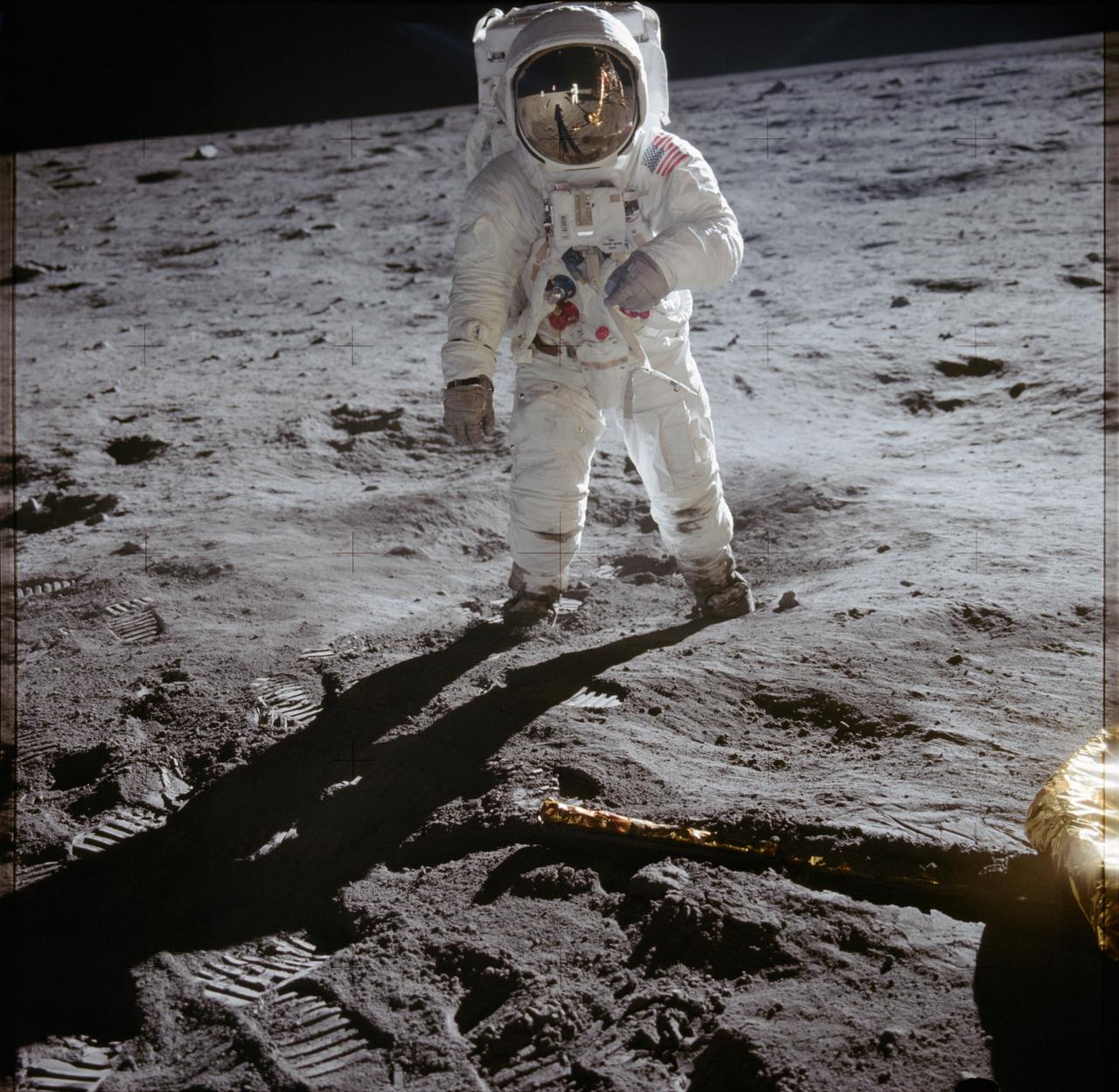
Buzz Aldrin at Tranquility Base, photographed by Neil Armstrong during the first lunar EVA.
Neil Armstrong / NASA · NASA Image and Video LibraryFirst human footprints on another celestial body; proved operational capability of crewed lunar landing and return.
Humanity's first extraterrestrial landing. LM Eagle landed with 25 seconds of fuel remaining in southwestern Mare Tranquillitatis.
The Moon from here.
One Moon. A different horizon at every longitude.
Map source & calculation notes
Natural Earth contributors; Tom Patterson and Nathaniel Vaughn Kelso. Public Domain. Natural Earth 4.1.0 geography redistributed by world-atlas. Equirectangular projection with antimeridian clipping; generalized coastlines, not navigation-grade.
Coordinates: Astronomy Engine, apparent equator of date. Station altitudes use observer-specific parallax and standard refraction at sea level. Snapshot refreshes each minute while this page is visible.
Natural Earth usage terms ↗Fragments of another world.
Petrology, radiometric isochron ages, and thin sections for curated lunar rock specimens brought to Earth.
Genesis Rock
Apollo 15
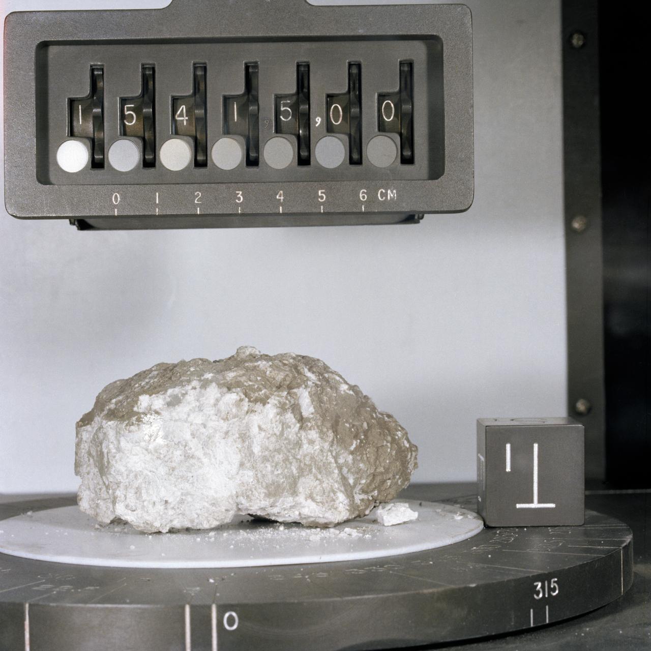
Sample 15415 in the Lunar Receiving Laboratory after its return aboard Apollo 15.
NASA · NASA Image and Video LibraryThe definitive physical evidence for the Lunar Magma Ocean hypothesis—a relic of the primordial crust that floated to the top of a molten Moon 4.5 billion years ago.
Granulitic anorthosite composed almost entirely of calcic plagioclase with complex deformation twinning and shock fractures.
Inquiry Knowledge Graph & AEO Questions
Hierarchical recursive search tree with atomic passages and peer-reviewed academic research citations.